
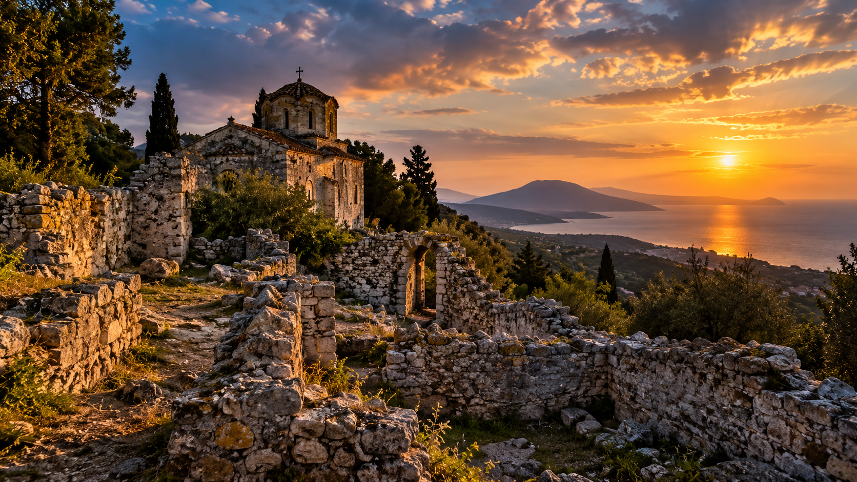
AZAKYNTHOS, THE ISLAND THAT HIDES ITS PAST: SUNKEN SHIPS, A LOST ISLAND, AND THE FORGOTTEN SECRETS OF ARGASSI
Beneath the waters of the Ionian Sea and among the ruins of old Argassi lies a history far more complicated than the one tourists are familiar with. It is the story of an island that changed its shape, of lost ships, an abandoned village, epidemics, pirates, noble families, and buildings gradually swallowed by the sea.
The Ships That Remained at the Bottom of the Ionian Sea
I have looked out over the sea of Zakynthos countless times without thinking that beneath its peaceful surface lie traces of civilizations that crossed these waters long before the island became a tourist destination. When I began investigating the history of these places, I discovered that the seabed preserves the remains of ancient vessels, commercial cargoes, Roman objects, and ships that sailed during the period of Venetian rule.
One of the most spectacular discoveries lies near Signallo Reef, also known as Dimitris, approximately one kilometer from the port of Zakynthos. There, at a depth of around ten meters, a shipwreck dating to the early modern period, associated with the sixteenth century, was discovered.
The story of its discovery is almost unbelievable. In 1980, Greek military divers detonated a bomb left over from the Second World War. The explosion disturbed the sediments on the seabed and exposed the wooden structure of a ship that had been lost several centuries earlier.
Thus, a weapon from a modern war accidentally revealed a vessel from the age of the great maritime powers of the Mediterranean.
Investigations conducted between 1990 and 1993 by Greek and British specialists documented the ship’s wooden structure, stone cannonballs, pottery, and other objects. Coins and the characteristics of the cargo contributed to interpretations of its connections with the commercial and military world of the sixteenth century.
See photographs of the sixteenth-century shipwreck and the objects recovered from the seabed.
But Signallo is not the only discovery.
Near Pelouzo Island, in Laganas Bay, archaeologists identified the remains of a much older shipwreck, dating to the Late Archaic or Classical period of ancient Greece. The vessel carried amphorae, containers commonly used to store and transport wine, olive oil, and other products. Today, its fragmented cargo provides evidence of the commercial routes that crossed the Ionian Sea more than two thousand years ago.
The archaeological investigation of Pelouzo is also described in the TROPIS V report on the underwater surveys of Zakynthos.
In northern Zakynthos, a Roman shipwreck dating to the first two centuries AD was also reported, containing amphorae, bronze objects, and architectural elements. This cargo reminds us that ancient ships transported not only food and luxury goods, but also materials intended for construction.
In the Marathias area, a Byzantine shipwreck was reported in 1997, associated with ceramic objects and a lead tube. Roman lead anchors have also been reported in the waters of Laganas Bay and the Alykes area, further completing the picture of an island that had stood along maritime routes for centuries.
These findings are discussed in publications concerning the work of the Greek Ephorate of Underwater Antiquities, including the TROPIS VII archaeological proceedings.
Each of these discoveries belongs to a different historical period, yet together they tell the same story: Zakynthos was never isolated from the ancient world. It was a stopping point within a network of journeys, commercial exchanges, wars, and encounters between civilizations.
And yet, one of the most surprising discoveries about the island concerns not a ship, but the very shape of the land itself.
When Vasilikos Was a Separate Island from Zakynthos
Few people know that the Vasilikos Peninsula, as we know it today, was not always connected to the rest of Zakynthos.
In 2017, a team of researchers led by Pavlos Avramidis published a geological study entitled Holocene Sedimentology and Coastal Geomorphology of Zakynthos Island, Ionian Sea: A History of a Divided Mediterranean Island.
The researchers examined sediments, microfossils, and samples collected through boreholes reaching depths of approximately thirty meters. They also used dating methods to reconstruct the transformations of the landscape over the last ten thousand years.
The result is extraordinary: before approximately 7,500 years ago, Vasilikos was an island separated from the rest of Zakynthos.
Between the two landmasses lay a marine area that gradually changed as sediments transported by water formed natural barriers. Over time, certain marine environments developed into lagoons, then into lakes and dry land, eventually connecting the two parts of the island.
In the area where the airport stands today, there was once Lake Makri. Historical accounts associate its drainage with nineteenth-century land reclamation, although the precise chronology of these works should be distinguished from the much older geological processes described by the researchers.
What appears today to be a permanent geographical configuration is, in reality, the result of transformations that unfolded over thousands of years.
Read the original 2017 scientific study about the prehistoric separation of Vasilikos (PDF).
Another detail of the research particularly intrigued me. Prehistoric flint tools discovered in Vasilikos show certain differences from materials found elsewhere on the island, and researchers discussed the possibility that these differences reflected the ancient geographical separation.
In other words, before Vasilikos became a peninsula, prehistoric people may have lived and traveled through a landscape very different from the one we recognize today.
And if nature could join two islands together, it could also transform or destroy other sections of the coastline.
This is where the story of Argassi begins.
Argassi, Where the Sea Swallowed the Old Coastal Road
Today, Argassi is known for its beaches, restaurants, and proximity to Zakynthos Town, but its history began long before the appearance of hotels.
Historical documents also record older forms of its name, including Ergasion. Some interpretations connect the name with agricultural activity and the cultivation of land, although its precise etymology has not been definitively established.
During Venetian rule, Argassi formed part of an agricultural and maritime landscape containing estates, churches, roads, towers, and water-supply installations.
The village’s best-known monument is its three-arched stone bridge, commonly called the Kamara of Argassi.
Today, the bridge stands in the sea, a short distance from the shore, and its image has become one of the symbols of the village. But it was not built as an ornament or as an isolated monument.
It formed part of a coastal road connecting the Sgournes area with Davia, passing beneath Kommeno Vouno and continuing toward Vasilikos.
Research published in 2025 by the ANTETI project of the Ionian University shows that the route of this old road can be traced through historical documents, including a map produced by Nicolò Gentilini in 1632 and a maritime chart prepared by Henry A. Moriarty in 1844.
The bridge crossed a stream locally known as the “river of the arch,” which descended from Mount Skopos and flowed into the sea.
The Argassi Business Association gives 1805 as the probable year of construction, a date preserved in local tradition and in descriptions of the inscription above the central arch. However, a study published in 2025 reads the inscription as 1806, leaving a small documentary discrepancy.
At the beginning of the nineteenth century, the Ionian Islands were passing through the period of the Septinsular Republic, and the bridge belonged to a world in which people traveled by horse, cart, and small boats.
Over time, the sea advanced over the old coastline, and the road disappeared.
This process is not merely a story passed down by local residents. Coastal erosion in Argassi has been documented through technical studies, including investigations carried out in the early 2000s along approximately 2.5 kilometers of coastline.
Read about the coastal engineering study of Argassi’s shoreline.
The Houses the Elders of Argassi Remembered
Here, documented history meets human memory.
Stories have circulated in Argassi about the ruins of houses lying farther out at sea, beyond the old bridge. Some local residents claimed to have seen them personally beneath the water, while others knew the story from their parents and grandparents.
These accounts referred to the years both before and after the devastating earthquake of 1953. According to this oral tradition, the buildings had not disappeared in a single catastrophe but had gradually been covered as the sea advanced.
This story led me to investigate historical maps, documents concerning coastal erosion, and underwater archaeological research.
What can be demonstrated is that the old coastal road disappeared and that the shoreline changed. What I have not been able to identify in the available archaeological reports is confirmation of house foundations offshore from the bridge.
It would be inaccurate to describe these remains as a sunken city, but it would also be wrong to dismiss the memories of local residents as mere inventions.
Oral history can preserve the memory of vanished places even when written documentation is incomplete.
In the case of Argassi, the story of the houses beneath the sea remains an open question in a location where the disappearance of part of the old coastline is already documented.
Lambeti, the Village of Nearly One Hundred Houses That Vanished from Mount Skopos
While the story of the submerged houses remains unconfirmed, near Argassi there is another lost village about which historical documents provide much more concrete information.
Its name was Lambeti.
The settlement stood on the slopes of Mount Skopos, and today much of the area is covered by vegetation.
According to historical research presented by the Argassi Business Association, Venetian records from the 1520s and 1530s mention nearly one hundred houses and several hundred inhabitants. Lambeti was reportedly the fifth-largest village on Zakynthos at that time.
I find it remarkable that such an important settlement could disappear almost entirely from the island’s familiar landscape.
The origins of its population are connected, according to local historical interpretations, with the Lambeti family and communities of stradioti, soldiers who served Venice. Some of these people came from mainland regions and the Peloponnese during a period when Ottoman expansion caused significant population movements.
These soldiers did not live exclusively by warfare. In peacetime, their families cultivated land, raised livestock, and managed agricultural estates.
Lambeti experienced a period of prosperity during the sixteenth century, but its location did not completely protect it from danger.
Pirate attacks, earthquakes, insecurity, and possible internal conflicts contributed to the settlement’s decline. As its population decreased, houses were abandoned, deteriorated, or dismantled, and building materials may have been reused elsewhere.
What had once been an entire village eventually became covered by vegetation.
Panagia Akathistos, the Church of the Lost Village
Within the history of Lambeti appears a religious monument with particularly interesting documentation.
The church of Panagia Akathistos, also known as Panagia tou Lambeti or Kyria ton Angelon, served as a religious center for the old community.
A notarial document dated May 11, 1588, mentions the monk Akakios Skliros in connection with the organization of monastic life at the church.
The document is important because it demonstrates that the religious establishment existed during a period when Lambeti was still part of the region’s economic and spiritual life.
After the village declined, the church continued to appear in documents and local traditions. According to one account, its principal icon of the Virgin Mary was later transferred to Vlacherna to protect it from deterioration and the effects of earthquakes.
This transfer is recorded as a local tradition rather than as a fact established through a complete inventory of religious objects.
I find it striking that, after the disappearance of the houses, the name of an entire village could survive through a church and the memory of an icon.
The history of the church and its connection with Lambeti can be explored through the Argassi Business Association’s historical documentation.
Vlacherna, the Church of the Merchants of Argassi
The church of Panagia Vlacherna, also known locally as Vlacherena, has a history directly connected with the economic life of Venetian Zakynthos.
Local historical accounts associate its origins with the sixteenth century and indicate that the church was connected, during different periods, with commercial guilds.
Under Venetian rule, it was associated with the grocers’ guild and later with other groups of merchants dealing in food products.
In the society of that time, churches were not merely places of worship. They were also centers of professional communities, where people practicing the same trade gathered, organized celebrations, and strengthened their social relationships.
An important religious festival was held at Vlacherna, accompanied by a procession of the icon.
The connection between Vlacherna and the old Panagia Akathistos of Lambeti is particularly interesting because it illustrates how the memory of a vanished community could continue to live within the churches of another settlement.
Explore the historical churches and monuments of Argassi, including Vlacherna.
The Lazaretto, the Plague, and the People Who Never Returned Home
Before reaching Argassi from Zakynthos Town, the old road passed through an area known as Lazareto.
Here stood a quarantine institution intended for people and goods that might carry contagious diseases onto the island.
During Venetian rule, epidemics represented one of the greatest threats to port cities. Ships brought merchandise, money, and people, but they could also bring the plague.
Venice had developed a system of sanitary control that included inspecting vessels, isolating travelers, and imposing compulsory quarantine periods.
Historical accounts associate the establishment of early quarantine facilities in the Ionian Islands with the late sixteenth century, within a sanitary system that continued, with modifications, into the period of British administration.
According to local historical descriptions, walls of the old quarantine complex survived along the road toward Argassi. Inside were two churches, an Orthodox one dedicated to Saint Nicholas and a Catholic one dedicated to Saint Anthony of Padua.
The existence of these two places of worship recalls the multicultural character of the island, which for centuries stood at the intersection of the Greek Orthodox world and Catholic Venetian administration.
Among the people associated with the history of the lazaretto was Ioannis Varvakis, the well-known Greek merchant and benefactor who died in 1825, and the painter Ieronimos Plakotos, who reportedly died of plague in 1728.
According to local historical accounts, Plakotos’s works were destroyed by burning because of fears of contamination.
This story particularly disturbed me because it reminds us that epidemics destroyed not only human lives but also documents, objects, and works of art that might have told us much more about the past.
The lazaretto was not merely a medical institution. For those isolated within its walls, it was a place suspended between the hope of returning home and the possibility of never leaving.
The location of the old Lazareto along the vanished coastal road is also mentioned in the Ionian University’s study of the Argassi Bridge.
The Domeneghini Tower, the Secret Society, and the House Said to Be Haunted
Among the most interesting historical monuments of Argassi stands the Domeneghini Tower.
The Domeneghini family is associated with the Venetian-origin aristocracy of Zakynthos. According to local genealogical tradition, members of the family settled on the island after the fall of Candia in 1669, and their name was entered in the Libro d’Oro, the register of nobility, in 1741.
The tower was a fortified residence, adapted to an era when pirate raids and coastal insecurity encouraged wealthy families to protect their properties.
Over time, the building became a manor house associated with aristocratic life, but also with political meetings.
Before the Greek Revolution of 1821, the clandestine organization Filiki Eteria was preparing the liberation of Greece from Ottoman rule. Its members needed discreet places for meetings, transmitting messages, and organizing support.
According to local tradition, the Domeneghini Tower was used for such activities.
The most unusual part of the story is the legend of the haunted house.
It is said that those attending secret meetings deliberately encouraged rumors of supernatural presences to discourage curious visitors. Sometimes they supposedly threw stones from the windows, producing noises that strengthened the building’s reputation as the “devil’s house.”
If the story is true, it represents an ingenious use of popular superstition to protect clandestine political activity.
Another tradition connects the site with Theodoros Kolokotronis, one of the leaders of the Greek Revolution, who is said to have departed secretly from the nearby shore toward the Peloponnese.
These accounts appear in local history, although some details have not been independently confirmed through documents contemporary with the events.
Even so, they reveal the atmosphere of an era in which political conspiracies were real and an apparently haunted house could provide refuge for people preparing a revolution.
See photographs of the Domeneghini Tower and read the story of the haunted house and Filiki Eteria.
Vrysakia and the Vourderi Aqueduct, the Structure That Brought Water to the Town
One of the least-known parts of Argassi’s history concerns the water supply of Zakynthos Town.
In the Vrysakia area, natural springs provided water that was transported toward the town through a system of conduits and aqueducts.
The structures known as Kamares Vourderi date from the period of British administration in the nineteenth century, when the authorities devoted greater attention to sanitary infrastructure and water supply.
The aqueduct used natural differences in elevation to transport water toward the town. Its stone arches provided an engineering solution for crossing uneven terrain.
Before the development of modern systems, water supply was an essential concern for local inhabitants, and the functioning of a town depended on springs, wells, cisterns, and conduits.
An interesting historical detail is the name Vourderi, which also appears as the designation of a coastal area in Argassi. Local research associates it with an old family, and this overlap between a family name, a location, and a structure demonstrates how closely property ownership and village geography were connected.
The aqueduct was not a decorative monument but infrastructure essential to daily life, constructed at a time when access to clean water was enormously important.
See the historical monuments of Argassi, including the Vourderi arches.
Saint Spyridon of Sgournes and the Churches of the Vanished Coastline
In the Sgournes area stands the church of Saint Spyridon, one of the old religious buildings of the Argassi region.
Its history can be traced in local sources at least as far back as the sixteenth century, during a period when rural communities on Zakynthos were organized around churches, agricultural estates, and the families who administered the land.
The old coastal road passed near the church before continuing toward Argassi and Vasilikos.
This information is important for reconstructing the historical geography of the area because it demonstrates that the coastal route was not isolated, but formed part of a road network connecting several communities.
Other places of worship also existed in the region, some of which disappeared or were severely damaged by earthquakes and changes to the coastline.
One particularly unusual local story concerns a stone that once stood near the church of Saint Spyridon, known as “The Monk’s Head.”
According to the legend, a monk cursed the saint after a fish escaped from his grasp into the sea, and his punishment was to have his head turned into stone.
Naturally, this is not a historical event but part of the island’s religious folklore. Nevertheless, such legends are important because they reveal how communities explained natural formations and unusual events, transforming them into moral stories.
Explore the history of Saint Spyridon of Sgournes and the other religious monuments of Argassi.
Agios Nikolaos Megalomatis, a Byzantine Church Hidden on Mount Skopos
On Mount Skopos, not far from the old roads connecting Argassi with Vasilikos, stand the remains of one of the most interesting Byzantine monuments on Zakynthos: the church of Agios Nikolaos Megalomatis, also known as Stratilatis.
Unlike many local stories based on tradition, this monument has been studied scientifically.
In 1989, researcher Grigorios Poulimeros published an architectural study examining the building’s construction phases and identifying interventions dating between the tenth and twelfth centuries.
The research indicates an initial construction phase between 944 and 1010, followed by alterations during the twelfth century. The study examined the walls, vaults, interior organization, and traces of mural paintings.
The church continued to be used during Venetian rule and is documented in later historical records.
This continuity is remarkable. In a place where nature and earthquakes have transformed the landscape so many times, the monument preserves traces of a religious history extending back almost a thousand years.
Agios Nikolaos Megalomatis demonstrates that the Skopos region did not become important only during Venetian rule. It had already formed part of the island’s religious landscape in the Byzantine period.
Panagia Skopiotissa and the Memory of an Ancient Sanctuary
Higher on Mount Skopos stands the monastery of Panagia Skopiotissa, one of the region’s best-known religious monuments.
Local historical tradition associates the site with the existence of an ancient sanctuary dedicated to the goddess Artemis.
Such overlaps between ancient places of worship and Christian religious sites are known throughout many regions of Greece. Sometimes a church was built near an earlier sanctuary, while in other cases materials from older structures were reused.
In the case of Skopiotissa, the association with Artemis is interesting, but it must be treated cautiously in the absence of sufficient archaeological evidence to reconstruct the ancient sanctuary precisely.
What can be stated is that Mount Skopos possessed religious and strategic importance over a long period.
Its commanding position overlooking the sea, Vasilikos, and the coastline toward the Peloponnese made it a natural observation point, but also a secluded place suitable for monastic life.
See an authentic photograph of the ruins of Panagia Skopiotissa on Wikimedia Commons.
The Watchtower at Davia and the Fear of Pirates
Near Cape Davia, the remains of a coastal defensive structure are mentioned in connection with the tradition of observation towers known as vardioles.
These structures served a practical purpose: watching the sea and warning communities when hostile vessels approached.
During Venetian rule, pirate raids and maritime incursions represented a genuine danger to settlements throughout the Ionian Islands.
People living near the coastline were exposed to robbery, abduction, and the destruction of property, which made defensive towers, fortified houses, and warning systems important elements of the landscape.
It is no coincidence that many wealthy families built protected residences, while some communities preferred higher ground from which the sea could be observed.
The history of Lambeti, the Domeneghini Tower, and the coastal watchtowers must be understood within this broader context of maritime insecurity.
The sea brought trade and prosperity, but it could also bring destruction.
Destroyed Churches, Lost Graves, and the Memory of the Old Coastline
Along the road between Zakynthos Town and Argassi stood other historical buildings that have since disappeared.
A historical description of the region mentions the residence of the Roma family, known as Byzantis, and the church of Saint Constantine.
Near this church, a Russian captain named Stefanos Vasilovich Novoksenovi had been buried. According to local tradition, his death inspired a popular poem known as “Prinzipopoulos.”
During the Italian occupation in the Second World War, the church was reportedly demolished and the grave destroyed.
This episode reminds us that the disappearance of monuments is not caused only by earthquakes or erosion. Wars, demolitions, the reuse of materials, and economic transformations have all contributed to the loss of a significant part of Zakynthos’s heritage.
Another archaeological investigation recorded fragments of columns and architectural elements found in an old house in Argassi, associated with the church of Saint Spyridon.
Discoveries like these demonstrate that traces of the past are not always found where they were originally constructed. A column may end up inside a house, a stone from a church may be reused in a wall, and an inscription may survive long after the building to which it belonged has disappeared.
Earthquakes, Erosion, and the Disappearance of Old Argassi
To understand the history of Argassi, we must also consider the natural environment of the island.
Zakynthos lies within a region of significant tectonic activity, close to the convergence zone between the African and Eurasian plates.
Earthquakes have influenced architecture, settlements, and the lives of inhabitants throughout the centuries.
The devastating earthquake of August 1953 destroyed a considerable part of Zakynthos Town and severely affected numerous communities across the island.
However, changes to the Argassi coastline cannot be explained exclusively by this earthquake.
Coastal engineering studies document erosion, sediment movement, and wave action, processes capable of gradually transforming the shoreline.
The old three-arched bridge is one of the most visible witnesses to these changes.
Built to cross a watercourse and carry a road, it now stands within a landscape that no longer resembles the one for which it was designed.
And so I return to the stories about houses lying offshore.
If the old road disappeared, it is reasonable to ask what other buildings once stood along it and whether some were destroyed or covered by the sea.
For now, the documents consulted do not allow us to identify submerged houses in front of the bridge, but the history of the coastline provides a real context in which such accounts deserve investigation.
Argassi, Where History Has Not Entirely Disappeared
What impressed me most during this investigation was not the existence of a single spectacular monument, but the extraordinary number of histories that meet within such a small geographical area.
Near Argassi, there once stood a village of almost one hundred houses, now hidden beneath vegetation. On Mount Skopos survive traces of Byzantine buildings nearly a thousand years old. Close to the coast, a lazaretto recalls the age of epidemics, while an aristocratic tower preserves traditions of clandestine meetings before the Greek Revolution.
The churches of Vlacherna, Panagia Akathistos, and Saint Spyridon tell stories of communities, merchants, monks, and families who lived here before us.
The aqueducts of Vrysakia recall the efforts people made to bring water into the town, while the old bridge standing in the sea demonstrates how profoundly a coastline can change within only a few generations.
Farther away, beneath the waters surrounding Zakynthos, Greek, Roman, Byzantine, and early modern shipwrecks demonstrate that the island was connected to the history of the Mediterranean for thousands of years.
And the discovery that Vasilikos was once a separate island forces us to look at the very geography of the region through different eyes.
I began this investigation with a story passed down by the elders of Argassi, about houses supposedly lying beneath the sea beyond the old bridge.
I have not yet found proof of those houses, but I discovered something equally important: present-day Argassi represents only part of a much larger historical landscape, transformed by people, earthquakes, the sea, and the passage of time.
Not every story told by the elders may ever be proven. Some will disappear with the last people who heard them, while others will continue to survive in the memories of families.
That is precisely why I believe the history of a place should not be sought only in major museums or famous monuments, but also in vanished roads, ruins hidden among trees, the names of old families, and the stories passed down by those who lived there.
Because sometimes the past does not truly disappear. It simply disappears from what we have learned to see.
Historical and Scientific Sources
Underwater archaeology: TROPIS V, archaeological investigations at Signallo and Pelouzo, including photographs and archaeological drawings.
Click to access Tzalas-1999-Tropis-V.pdf
Photographs of the sixteenth-century Zakynthos shipwreck:
The prehistoric separation of Vasilikos: Avramidis et al. (2017), Holocene Sedimentology and Coastal Geomorphology of Zakynthos Island, Ionian Sea: A History of a Divided Mediterranean Island.
Click to access Avramidis_etal_2017_holocenee_sedimentology_ionian_sea.pdf
Scientific maps showing the four stages of Zakynthos’s prehistoric geography:
The old bridge and vanished coastal road: ANTETI Research Project, Ionian University (2025).
Coastal erosion in Argassi: MG Frangou, coastal engineering and shoreline protection study.
https://www.mgfrangou.gr/gr/ergo.php?ergo_Id=191
Lambeti, Panagia Akathistos, and the lost village: Argassi Business Association.
Domeneghini Tower and the traditions of Filiki Eteria: Argassi Business Association.
Historical churches, the Vourderi aqueduct, and other Argassi monuments:
Agios Nikolaos Megalomatis: Greek Ministry of Culture, illustrated restoration booklet.
Click to access megalomatis_zakynthos_fylladio%20%282%29.pdf
Panagia Skopiotissa: Historical photograph of the monastery ruins, Wikimedia Commons.
https://commons.wikimedia.org/wiki/File:Church_and_monastery_ruins_Panag%C3%ADa_Skopi%C3%B3tissa_%E2%80%93_Mount_Skop%C3%B3s_-Zakynthos–Greece%E2%80%93_01.jpg
Research note: Archaeological findings, documented historical events, local traditions, and oral testimonies have been distinguished throughout this investigation. The existence of submerged houses offshore from the old Argassi bridge remains unconfirmed by published archaeological evidence. Links to photographs and research reports are provided for documentation; their inclusion does not imply permission to reproduce copyrighted images.


Leave a Reply